1839 Tithe Map of Ropley and the local area
 Charlwood 495-562-min")
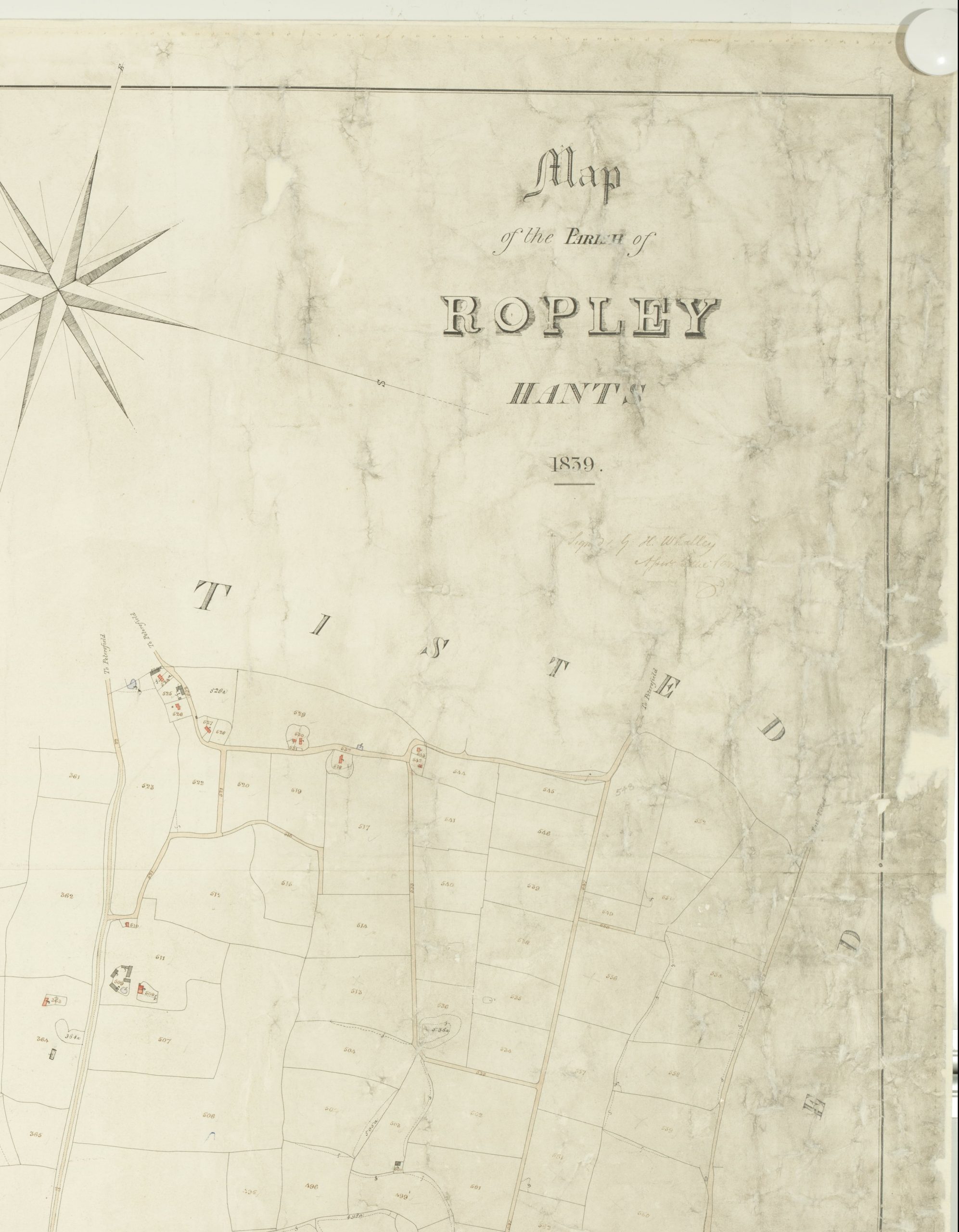
The Tithe map of Ropley Parish was created in 1839. This map is a vital record for not only research into Ropley of the 1800s but also of centuries previous. It is the most high resolution map of Ropley listing individual hedgerows and road sides. Each item is numbered and corresponds to the Awards which accompanies the map. The Awards list all the field, lane and place names along with tenants and landowners including the rents
The original Tithe Map and Awards are held at the Hampshire Records Office (HRO). Images of the maps can be seen here on our website. At present the images of the Tithe map are seperated into 9 sections. The original handwritten awards document can be viewed at the Hampshire Records Office or a scan can be viewed via request to the RHNA
The Original document was created by Charles Gearing and was recently transcribed by Manni Kirchner (2022). See the transcription here on our website.
Subject
Format
Collection
Hampshire Records Office HROCreator
Original document by Charles Gearing. Images taken by Hampshire Record Office (HRO)Date of creation
1839Date of coverage
1839Place
RopleyContributor
Hampshire Records Office (HRO)Language
EnglishReference number
ROP/009/005License
Creative Commons Attribution-NonCommercial-NoDerivs (CC-BY-NC-ND)Related links to other pages
- Historic Maps of Ropley
- Transcription of the 1839 Tithe Map Awards
- 1839 Tithe Map of Ropley and the local area
- 1801 -1841 Census transcription of Ropley and locality
- 1839 Tithe Map - Bowers Grove
- 1839 Tithe Map - Charlwood
- 1839 Tithe Map - Four Marks
- 1839 Tithe Map - Gilbert Street
- 1839 Tithe Map - Harcombe
- 1839 Tithe Map - Kitwood
- 1839 Tithe Map - Monkwood
- 1839 Tithe Map - North Street
- 1839 Tithe Map - Ropley Dene


No Comments
Add a comment about this page